Konadasapura · Whitefield–Hoskote Road · East Bengaluru
My Home Hoskote Apartments in Konadasapura
Explore My Home Apartments in Konadasapura, a proposed 52-acre township with 2, 3 and 4 BHK homes on Whitefield–Hoskote Road. View plans and amenities.
| Project detail | Current information |
|---|---|
| Site | 52 acres 24 guntas |
| Apartments | 5,735 proposed homes |
| Configurations | 2, 3 and 4 BHK |
| Programme | Apartments, retail, offices and community centre |
Request project details
Overview
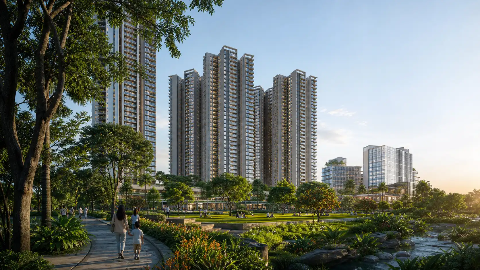
My Home Mixed Use Township is planned as a 52-acre 24-gunta district at Konadasapura rather than a stand-alone apartment enclave. Its programme combines 5,735 homes with retail, offices and a community centre beside Whitefield–Hoskote Main Road. The residential mix is led by 3 BHK homes: 3,833 of the stated total, compared with 1,189 two-bedroom and 713 four-bedroom apartments. That balance matters because it points to a family-oriented high-rise population while still providing smaller and larger choices. The broader scale is equally important. Residential buildings are described up to 46 upper floors, commercial buildings up to 34 upper floors, and the planning programme reaches a stated maximum height of 152 metres. For a buyer, the central question is therefore not simply whether a preferred bedroom count exists. It is how the selected residential block, phase and apartment relate to the commercial edge, open spaces and daily circulation of a large mixed-use neighbourhood. The overview brings those relationships together before the more detailed plan, systems and location sections.
- Site extent
- 52 acres 24 guntas
- Proposed apartments
- 5,735
- Apartment mix
- 2, 3 and 4 BHK
- Proposed built-up area
- About 445 acres of built-up floor area
- Maximum stated height
- 152 metres
Master Plan
The dated township drawing organizes residential Blocks A through L across the western and central parts of the parcel, with commercial Blocks M and N toward the eastern road frontage. Two park and open-space areas, two civic-amenity plots and a community building sit within that larger arrangement. This division gives the plan a clear urban structure: homes occupy the deeper residential field, while the commercial component addresses the major road edge. Internal roads are labelled at several widths, including 12, 18, 24 and 32 metres, alongside 16-metre driveways and fire circulation around the residential groups. A nala and its buffer shape the northern and western edges, while road-widening areas influence the approach from Konadasapura Road and Whitefield–Hoskote Road. These elements help explain why block choice can change the experience of arrival, landscape access and proximity to mixed-use activity. The master-plan study is most useful as a relationship map: it lets a household compare a quieter inner block, a road-facing position and access to the two open-space zones before moving to a specific tower and apartment drawing.
Master Plan
Floor Plans
The residential schedule contains three clear configuration families: 2, 3 and 4 BHK. The counts make the programme unusually transparent at the planning level. Two-bedroom homes account for 1,189 apartments, three-bedroom homes for 3,833, and four-bedroom homes for 713. The dominant 3 BHK share suggests that many towers and common services will be planned around larger family households, while the 2 BHK and 4 BHK groups create distinct alternatives at either end. Bedroom count alone cannot show whether a home will work well. A useful comparison considers the entry sequence, usable furniture walls, bedroom privacy, kitchen-to-utility movement, daylight openings and the amount of circulation between rooms. The three planning images organize those questions by configuration without supplying a project area that has not been published. This keeps the decision focused on what a current apartment drawing must answer: the exact area basis, tower and stack, balcony and utility treatment, structural interruptions and the way the plan handles shared versus private space. The configuration section therefore functions as a shortlist framework, not a substitute for the current unit drawing.
Amenities & Systems
Shared-space planning at My Home Mixed Use Township combines household amenities with infrastructure needed for a high-density district. The stated people-facing programme includes a children’s play area, native planting, a recreation centre and security provision. Behind those visible spaces sits a substantial systems layer: water treatment, sewage treatment, rainwater harvesting, organic-waste processing, solar water heating and photovoltaic panels. Landscape is quantified at about 5.14 acres with 2,600 proposed trees, so its distribution between residential blocks is as important as the headline total. The utilities also reveal the scale of operations. Planning figures include 6,930 KLD of water requirement, 6,500 KLD of sewage-treatment capacity, 6,000 cubic metres of rainwater storage, 100 recharge pits, 15,300 parking spaces and a 40 MVA power requirement. Together, these numbers describe a township that will depend on coordinated phasing and maintenance rather than a small collection of decorative facilities. The image-led cards separate leisure, landscape, security, water, waste and energy categories so buyers can connect each named system with the part of daily life it supports.

Children’s play area
Play equipment, soft ground and nearby seating create a family-friendly area for everyday outdoor activity.

Landscaped native planting
Native trees, shrubs and groundcover support shade, seasonal interest and a locally suited landscape.

Recreation centre
Shared lounges and adjoining outdoor areas support resident gatherings, community activities and informal meetings.

Security
Controlled entry equipment and surveillance points support access management at the residential approach.

Water treatment
Filtration vessels, pumps and connected pipework support treatment before water enters the wider utility network.

Sewage treatment
Treatment tanks, aeration equipment and reuse pipework support wastewater processing within the site systems.

Rainwater harvesting
Collection tanks, recharge pits and reuse pipework help retain rainfall and support groundwater replenishment.

Organic-waste processing
Segregated bins and an on-site processing unit support organised handling of biodegradable household waste.

Solar water heating
Roof-mounted collectors, insulated storage tanks and connected pipes support solar-assisted hot-water supply.

Solar photovoltaic panels
Rooftop photovoltaic panels and electrical equipment support on-site generation for shared energy needs.
Price & Cost Sheet
A useful price comparison for this township begins at the exact apartment rather than at a portal headline. The current project guide carries no settled project price or unit-area schedule, while the residential programme spans 2, 3 and 4 BHK homes across multiple blocks and phases. That means two quotations can look similar at the top line while describing different area bases, tower positions or charge structures. The price section separates the three configuration choices and focuses the commercial conversation on a dated cost sheet. For each candidate, the meaningful total includes the stated base consideration together with floor or location premiums, parking, facility charges, deposits, taxes, registration treatment and payment milestones. It also needs to identify the project company, phase, block, tower, stack and apartment area on the same document. This approach makes comparison possible even before a public rate card exists: a household can align the cost sheet with the corresponding plan, then compare like-for-like totals across shortlisted homes. The result is a cleaner decision than applying an unverified price per square foot to a configuration whose published area is unknown.
Gallery
The gallery explores six spatial parts of a mixed-use residential district: a planted promenade, a neighbourhood park, a residential arrival court, a lobby, an indoor recreation lounge and a pedestrian retail plaza. Read together, the sequence moves from public streets and open space into the more private resident journey. The promenade and park scenes help frame questions about shade, seating and continuous walking routes between blocks. The arrival and lobby studies shift attention to the transition from vehicle movement to a residential entrance. The recreation lounge represents the indoor social layer, while the retail-plaza scene shows how commercial activity might meet pedestrian circulation at the township edge. This progression is useful because the project is larger and more varied than a conventional apartment compound. A household can use the images to decide which spatial qualities deserve attention in current plans and specifications: separation from commercial traffic, the continuity of planted routes, the character of arrival, and the practical relationship between recreation space and the selected residential block. The gallery is therefore a visual companion to the master-plan and systems information, with each scene serving a different comparison question.
Promenade context study
Open-space context study
Arrival context study
Lobby context study
Recreation context study
Retail-street context study
Location
Konadasapura places the township directly in the Whitefield–Hoskote growth corridor, beside Whitefield–Hoskote Main Road or SH-35. The available distance set gives the location section a practical range rather than a single landmark claim. Orion Uptown Mall is approximately 1.5 km from the planning point, New Baldwin International School Mandur about 5.2 km, MVJ Hospital about 8.4 km, Kadugodi Tree Park metro about 8.8 km and International Tech Park Bengaluru about 10 km. Delhi Public School Whitefield is approximately 12 km and EPIP Whitefield about 15.8 km. The project material separately places Whitefield Railway Station at about 5.7 km and Kempegowda International Airport at about 29 km. These distances show three different location scales: nearby retail, east-Bengaluru education and healthcare, and longer employment or regional journeys. For households working around Whitefield, the corridor relationship may be the strongest advantage; for airport-heavy travel, the regional route remains materially longer. The location section lets buyers compare those priorities from one consistent project-area anchor while keeping the selected block and actual entrance as part of the final route decision.
Whitefield–Hoskote Main Road, Konadasapura, Bidarahalli Hobli, Bengaluru East, Karnataka, IN
Road
| Destination | Locality | Distance | Route |
|---|---|---|---|
| State Highway 35 | Whitefield–Hoskote Main Road / SH-35 | 0 km · at site edge | Approximate distance reproduced from the planning record; not an independent route measurement. |
Railway station
| Destination | Locality | Distance | Route |
|---|---|---|---|
| Whitefield Railway Station | Whitefield Railway Station | ~5.7 km | Approximate distance reproduced from the planning record; not an independent route measurement. |
Airport
| Destination | Locality | Distance | Route |
|---|---|---|---|
| Kempegowda International Airport | Kempegowda International Airport | ~29 km | Approximate distance reproduced from the planning record; not an independent route measurement. |
School
| Destination | Locality | Distance | Route |
|---|---|---|---|
| Delhi Public School Whitefield | DPS Whitefield, K Mallasandra Village, Hoskote Taluk | 12.0 km | Shortest displayed ordinary driving route from the available planning point to DPS Whitefield Mallasandra. |
| New Baldwin International Residential School | New Baldwin International Residential School, Budigere Cross–Mandur Road | 5.2 km | Shortest displayed ordinary driving route from the available planning point to New Baldwin International School Mandur. |
Hospital & college
| Destination | Locality | Distance | Route |
|---|---|---|---|
| MVJ Medical College and Research Hospital | MVJ Medical College and Research Hospital, NH-75, Hoskote Taluk | 8.4 km | Shortest displayed ordinary driving route from the available planning point to MVJ Hospital on NH 75. |
Employment
| Destination | Locality | Distance | Route |
|---|---|---|---|
| International Tech Park Bangalore (ITPB) | International Tech Park Bangalore, Whitefield Road | 10.0 km | Shortest displayed ordinary driving route from the available planning point to ITPB via Whitefield–Hoskote Road; a faster live-traffic alternative was longer. |
| EPIP Whitefield | Export Promotion Industrial Park, Whitefield | 15.8 km | Shortest displayed ordinary driving route from the available planning point to EPIP Zone, Whitefield. |
Shopping
| Destination | Locality | Distance | Route |
|---|---|---|---|
| Orion Uptown Mall | Orion Uptown Mall, Old Madras Road, Sannatammanahalli | 1.5 km | Shortest displayed ordinary driving route from the available planning point to Orion Uptown Mall. |
Metro
| Destination | Locality | Distance | Route |
|---|---|---|---|
| Whitefield (Kadugodi) / Kadugodi Tree Park metro | Whitefield and Kadugodi Tree Park metro stations | 8.8 km | Shortest displayed ordinary driving route from the available planning point to Kadugodi Tree Park metro via Whitefield–Hoskote Road; a faster live-traffic alternative was longer. |
Road, rail-station and airport figures are approximate.
FAQ
The main buyer questions arise from the size and mixed-use character of the proposal. The project name refers to a township at Konadasapura with residential, retail, office and community components, not to one completed apartment tower. Its stated 5,735-home programme is divided among 2, 3 and 4 BHK configurations, yet the current guide does not attach project-specific apartment areas to those labels. The master-plan section explains the residential A–L blocks, commercial M–N blocks, open spaces and civic plots; the floor-plan section shows how to compare the three bedroom-count choices; and the amenities section separates recreation and landscape from township-scale water, waste and energy systems. Location questions centre on SH-35 and the Whitefield–Hoskote corridor, with measured references to schools, healthcare, metro, employment and retail. Price questions remain unit-specific because a public rate card is not part of the current content. Read together, the answers show how to move from a very large planning programme to one coherent home shortlist: first choose the residential context and configuration, then connect the apartment plan, phase, block and commercial sheet that describe that same choice.
What is My Home Mixed Use Township?
It is the name stated in reviewed planning material for a proposed mixed-use township at Konadasapura, with apartments, retail, commercial offices and a community centre.
Where is the project located?
The location is stated as Konadasapura, Bidarahalli Hobli, Bengaluru East, beside Whitefield–Hoskote Main Road or SH-35.
How large is the proposed site?
The proposed site is stated as 52 acres 24 guntas, with about 445 acres of proposed built-up floor area across the mixed-use programme.
How many apartments are proposed?
The stated total is 5,735 apartments: 1,189 two-bedroom, 3,833 three-bedroom and 713 four-bedroom homes.
Which apartment configurations are included?
The reviewed programme includes 2 BHK, 3 BHK and 4 BHK apartments. This listing does not publish unit areas because a project-specific area schedule was not established.
Are the floor plans official project plans?
No. The three floor-plan visuals are generic, label-consistent studies. They are not project drawings, measurements, stacks, orientations or availability statements.
Is the master-plan image official?
No. It is a source-informed site-plan study of the dated plan provided for this listing.
What facilities are stated?
The planning material describes children’s play, landscaped native planting, a recreation centre, security and several water, waste and solar systems. Generic third-party amenity lists are excluded.
What price is published?
This listing publishes no home price. Request a dated cost sheet tied to the exact project, phase, configuration, area basis and legal entity.
Is a launch or possession date published?
No launch date, possession date, current inventory or booking status is published on this listing.
Who is the project company?
Sreni Nirman Private Limited is the project company named in the reviewed planning material. A separate project-specific document would be needed to establish any developer, promoter or seller relationship. This site is an Authorised Channel Partner for My Home Mixed Use Township.
Is this an official builder website?
No. This is an independent project-information listing. The My Home Constructions website informed the visual direction only. This site is an Authorised Channel Partner for My Home Mixed Use Township.
How far is Whitefield Railway Station?
The planning material states approximately 5.7 km. Treat it as a source-stated reference and check the live route from the confirmed entrance.
How should I prepare for a site visit?
Request the current address, confirmed gate, approach-road note, phase plan, configuration drawing and responsible sales entity, then check live routes for your daily destinations.
Continue your project shortlist
Connect the selected residential block, 2–4 BHK choice and township phase before comparing a plan with its commercial sheet.